
Return to audio interview | Next episode | Explore UC Science Radio
Molly Magid: Welcome to UC Science Radio, where we interview a range of postgrad students to tune into the fresh voices entering the world of science and learn what sparked their passion. I’m Molly Magid, a Master’s student in the School of Biological Sciences.
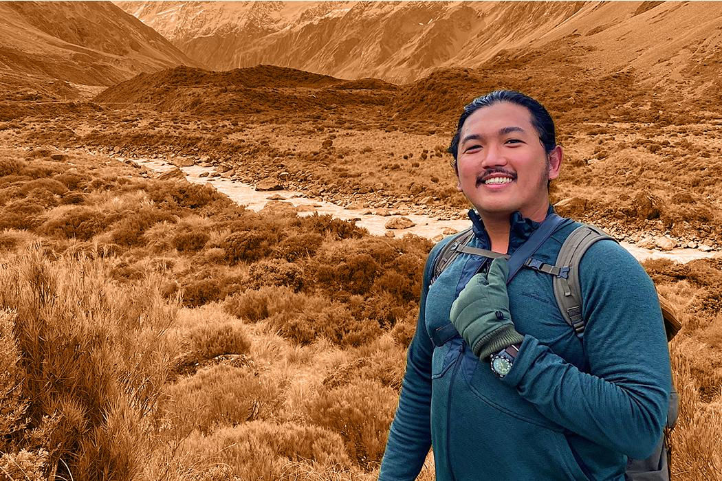
Today I’m talking with David Garcia. He's a PhD student studying geospatial science. His research is an ethnography of crowdsourcing and mapmaking. He's also the founder of the Ministry of Mapping, a geospatial mapmaking collective that does crisis mapping, and most recently they did crowdsourcing to map the location, treatment capacity, and resource needs for healthcare centres in the Philippines.
Kia ora David, welcome to UC Science Radio!
David Garcia: Kia ora and kamusta! Thanks for having me here.
So you're studying geospatial science, but specifically what's your research about?
DG: The focus is about the latest trend in the production of geographic knowledge which is more digital, more networked, in our case popularly known as crowdsourcing. If you look at Wikipedia, there is a version of that in the mapping world called OpenStreetMap. And let's say you're opening Facebook, or food delivery to your house, or for government agencies responding to major crises, OpenStreetMap is usually there. People see it as the rival of Google Maps, and for a good reason because OpenStreetMap has democratised the access to the production of maps and digital mapping.
So I am studying the people who are making OpenStreetMap, that's why I chose an ethnography, and more dealing with the nature of the production of geographic knowledge. When I looked around and read the literature and also did lots of reflections, I noticed that mapmakers are people too. Also, I chose this approach because, for the past hundreds of years people like me, from marginalised backgrounds, we have been studied by anthropologists, our tribes, our peoples. And I said maybe you should flip the gaze, if before ethnography and cartography have been used to study my peoples, peoples from the so-called developing world, how about using ethnography to study the cartographers who are people too.
And also my work recently has turned a bit into de-colonial work, because I also noticed there's a serious problem about racism and sexism in the mapping industry. Centuries ago, the people who made the maps were usually white guys. And unfortunately, this is a problem in science in general—you know, that image of the white man exploring and saving the world, that desire is still there. So I also try to push back against that, and also recognise that I am part of the problem, because I should have been aware of these a long time ago. And then I said: "Oh god I need to change the messages that I've been seeing about what mapping is and what's important."
As a crisis mapper, let's say there's a cyclone, and then the locals are, you know, need to fight for food and water that kind of ethic of following the natives, and locals, and indigenous people is suspended by the international organisations out of the assumption that "oh we need to save them," and we forget to make sure that the process of responding builds the capacity of the peoples. Don't try to assume that you know what's best for them, because they know the place better than we do. So that's what I'm trying to understand: the nature of the production of geographic knowledge in today's digital age.
So is it similar to Wikipedia where there are just people who are adding this information without payment? And then what are some of those demographic characteristics that may lead to biases in these mapmaking communities?
DG: Who makes these maps? People like us, in general, volunteers, some of my folks are paid, some are not, mostly it's not paid. It's like Wikipedia too, very, very similar. Citizens, activists, humanitarians, business people, entrepreneurs, government officials. And for me that's a fascinating part because historically the production of the maps in the Western sense, the Western cartography, has been in the hands of the few, usually with the government. And due to the latest technologies, there's more opportunities for ordinary people, citizens to contribute, and make our own maps, and edit the maps, and determine what the maps are for, and correct maps, teach others to map because there are many possible lives in the world, there are many possible maps too.
Which lead me to the biases. I've been thinking about that too because it's a strong tradition in geospatial sciences to measure accuracy and error. And that it helpful, but there are many kinds of maps in the world and it's unfortunate that because of the people that needed it before, that really benefited them. Like the military was going to bomb someone, they needed a really precise dot. But you know, for the everyday individual who just wants to go a shop, you don't really need very precise data about that, just the name and where's the street, etc.
I'll give an example, before in OpenStreetMap, folks were only interested in buildings and roads. But that's not the only reality in the world. So my friends have been saying, "hey let's also map safe spaces for LGBT communities, that has to be on the map." Or “let's have safe spaces for women who suffered violence from their partners, where can they go?” What I've learned from the OpenStreetMap community is because we have different needs, we have different measures for what counts as geographic truth, what is real on the ground. And for me that's the amazing part.
You cofounded Ministry of Mapping, and that focuses on crisis mapping. So what was that process like of founding it and then of ongoing crisis mapping, what is that like?
DG: I am part of a cohort of a generation of Filipino mapmakers. We care for each other because we care for the same things too. And some of us map, let's say, mental health facilities, some of us map places where you can get HIV treatment. Or some of us do the very hard calculations about where the typhoon will go and which areas will get affected. So I cofounded it with a few friends because we noticed that through the years, we needed an organisation that will take care of the mapmakers. I have been doing crisis mapping for a while now. I started with hazards and health, and then I went to disasters, and then there was a time in 2013 when the Philippines was hit by the strongest cyclone to make landfall in world history. That cyclone is called Super Typhoon Haiyan and the image of a whole city devastated overnight and the houses are destroyed. And so was like my baptism of water. Later I went into mapping, like let's say there's a battle, there's a war zone, and the reconstruction. I'm also an urban planner and community worker.
And over the years, I realised that there's a lack of support system for people like me. It's only recent that issues for example like mental health of post-traumatic syndrome disorder, which I have, are being discussed. It's like a silent killer for crisis responders. We deliver this information, and hopefully make a change, but it also leaves the information workers very burnt out and very exhausted. And when the pandemic happened, I wanted to make sure that when we respond, someone will be there for the people who care. It's more of a caring collective, a support collective, so when people ask: "Hey where are the maps? What are the maps of the Ministry of Mapping?" Well, these are being done by the members. We are a collective because at the end of the day, mapping is both social and technical. And the research about mapping has been on more of the technical side, but people make it happen. And I've noticed that in my international collaborations, it's really just the maps that matter, and it's very dehumanising, too. And, in my culture, the people are more important than the maps and the mapping.
It's also a kind of an accountability group. So let's say we're gonna start a mapping project, or do something like a workshop, people comment and say, how about this aspect or this aspect?” And then we help improve each other. I've also realised for such problematic patterns like racism and sexism to change, first we need to decentre the mainstream practices and habits, some of them are ugly. And even myself, I have to decentre myself, so at the end of the day I want to make sure it's not just all about me. So I play support, I retreat, try to help get some funding. At the end of the day, without people there would be no mapping, hence the Ministry of Mapping.
Yeah everyone always thinks of, especially in science, the outcomes of your work, that's what you're measured against. And especially in times of crisis, like the pandemic, to do the important work that we need to get done, those people need to be supported.
DG: Yeah and it's been a tough year in general. I'll give a quick story, so last year, I went back to the Philippines for the holidays. But then we were hit by a cyclone in the same places that were hit by Super Typhoon Haiyan houses were destroyed again, I made a map. I went back to Manila, and then the next day the volcano in our island exploded and we had to map evacuation centres. And then I came here around mid-January, and then the pandemic happened. And then last Sunday, we were hit by another cyclone, by the strongest cyclone of 2020, which is stronger than Typhoon Haiyan in 2013. The Ministry of Mapping, the people I work with, these are my ride-or-die gang—war zones, pandemic, cyclone disasters, we're here for each other.
Yeah and it seems like that example of your year, which sounds crazy, it seems like these crises are only going to keep happening, especially when it comes to like natural disasters. It's going to have to become normal because of things like climate change. Starting those structures now is necessary.
DG: We also bring a Pacific worldview here, because think about it, and I am borrowing ideas now. In the old literature about disasters, risk reduction, crisis management, it was something like there are stable times, stable, stable, stable, and then there's a crisis. But in our world view, especially in the Pacific we have cyclones, we live with volcanoes, maybe this is what the Western academics have gotten wrong all along, that actually crises are the normal, and then we have relatively short periods of stability. It's very hard to accept, but if you live our lives, at least for the past five hundred years, if you add the colonisation to that and the war, it's what's happening right now, and we need to deal with it together by having very caring and supporting and resilient social relationships. Because at the end of the day, organisations come and go, and projects come and go, but in the case of me and my people I care about, the Ministry of Mapping, we’re still here.
So my last question for you is, what would be one big change you'd like to see come out of your research?
DG: The specific change I'm after is for the organisations and the leadership of mapping organisations to change, because I think it matters. Who tells those stories while mapping, and who gets powerful due to the stories and the mapmaking. Because for the past hundreds of years, peoples like us, and our native and indigenous relatives all around the world have been disadvantaged by mapping.
There's this quote by Jim Enote, he's part of the Zuni nation near the Grand Canyon, he said: "maps have caused so much trouble and we've lost more lands to mapping than to actual physical conflict." And if mapping was done to disempower millions of peoples around the world, it's happening right now, how about let's use mapping to change that. And I argue that there's a higher chance of that happening in this age of climate extinction and ecological crisis, for us to succeed in regenerating nature, for example, if native and indigenous peoples are leading the production of geographic knowledge.
Let's follow native and indigenous people, friends.
Thank you so much for coming on.
DG: Thanks for listening!
Return to audio interview | Next episode | Explore UC Science Radio
