Menu

Wananga landing Wananga landing
Topic

Bathymetry

30 January 2024

Our school has several methods available for mapping beneath the water depending on the accuracy required and how deep the water is. Check out our bathymetry field equipment.

APPLY NOW

The School has a number of methods available for mapping beneath the water depending on accuracy required and depth of water.


Muritai


Introduction

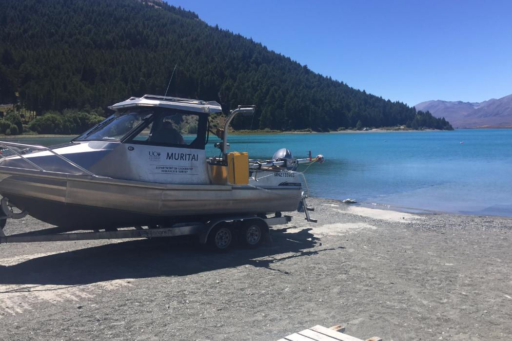
The Muritai (Maori for Sea Breeze) is the schools 6m Stabicraft boat used for surveying and deployment of various coastal sensors. Purchased in 2010, the Muritai has been used for a number of bathymetric surveys around Canterbury and High Country Lakes round the South Island. The School's boat operator Nick Key is licensed to operate the vessel in all coastal waters around New Zealand and in all lakes where power boats are allowed.

The Muritai has a Bathyswath system mounted to it. This is an amazing system which can allow bathymetric data to be collected at a much faster rate across a wide swath width. The operating swath of the bathymetric system ranges from 15 to 20 times water depth in depths less than 15m.

The Muritai also has a custom built sea chest for our single beam transducer which makes for extremely good (low noise) soundings, while our RTK Trimble R8 GNSS setup allows us to compensate in realtime for tide and heave.

There is a 100kg Davit crane for deploying equipment like ADCPs and our S4 current meter. The closed cabin allows us to operate in all types of weather at all times of the year.


Latest projects
  • Avon/Heathcote Estuary mapping
  • Lyttelton Harbour mapping
  • Lake Te Anua monitoring


Specifications
FeaturesParticulars
Endurance7hrs @ 65% power
Max Speed30 knots
MNZ number133963 Safe Ship Management Company
Sensor capabilitiesODOM Hydrotrac single beam echosounder with hull mounted 200khz transducer and pole mounted side scan transducer
Trimble R8
Bathyswath 
Teledyne Workhorse Sentinal ADCPs (600 and 1200khz)
Manta multi parameter water quality sonde
Wildco petitie ponar bethnic grab sampler
Automatic water sampler
S4 current profiler
Max persons 6
Size6.3m 
Motor4 stroke Yamaha 115 hp and 9.9 hp auxiliary
Fuel150l
MaterialsAlloy
SurveyJet


Introduction

The SurveyJet was an idea that came to the groundfloor staff after spending weeks GPS surveying up to their knees in mud for a project looking at long term sediment monitoring in the Avon Heathcote Estuary and Lyttleton Harbour. There had to be a better way and the SurveyJet is that way! The hull was custom built for us by a local boat builder and we kited it out with all the gear and software needed to enable high precision bathymetry mapping. The additional live telemetry data and FPV camera allow you to operate safely out of line of sight, making this the ultimate sensor platform.

This remote controlled jetboat can survey in water less than 20cm, at speeds of over 40km/h. The high speeds enable us to deploy the SurveyJet in shallow rapid flowing rivers which are otherwise impossible to survey. With a range of over 2km this boat can be deployed beyond line of site for HD cinematography or high precision bathymetric surveying and side scanning. The FPV enabled Go Pro on the bow enables us to get amazing up close video of features like a glacier terminus or bridge structure without having to put a person in harms way.

The SurveyJet has been deployed in Lake Tasman where it collected bathymetry data and video footage of the Tasman Glacier terminus from literally under the glacier! This is footage and data that is impossible to collect any other way! Soon to be a star in the new Underneath NZ documentary series, the SurveyJet draws a crowd wherever it goes. It is used for both student projects and staff research and because it is so easy to operate, anyone can pilot it.


Latest projects
  • Lake Tasman
  • Hurunui Mouth
  • Wainono Lagoon
  • Lake Kate Sheppard


Specifications
FeaturesParticulars
RangeOperated successfully at over 2km - actual range yet to be established
DurationUp to 1 hour
Cruise Speed5 knots (max speed 20 knots)
Sensor capabilitiesTritech PA500 digital precision altimeters
Garmin 7407xsv with Side Scan
Trimble R8
Go Pro Hero 3+
Battery capacityLipo 6S 16000 mA and 12 Volt Gel Cell
AutopilotNot yet as too much fun to drive but is coming
FPV5.8Ghz Fatshark with Go Pro
TelemetryCustom built by Tobias Schulmann (Geography PhD student)
WeightApprox 20kg
Payload10kg
Dimensions0.6m (width) x 1.5m (length) x 0.4m (depth)
MotorElectric
MaterialsAlloy
Geography-Kayaks

Kayaks
Our kayak fleet is designed to navigate rivers, lakes and beaches.

Geographer-on-the-lake

Bathyswath
The Bathyswath bathymetric and seabed mapping survey system is derived from the SWATHplus system.

Privacy Preferences

By clicking "Accept All Cookies", you agree to the storing of cookies on your device to enhance site navigation, analyse site usage, and assist in our marketing efforts.